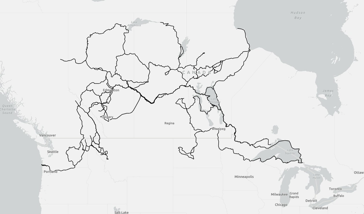
The Travels, Explorations and Surveys of David Thompson between 1785-1812

An artist rendition of David Thompson
David Thompson was born on April 30, 1770. Orphaned at 7, he was placed in Grey Coat Charity School. Upon graduation at 14, he was apprenticed to the Hudson’s Bay Company (HBC), where he schooled to develop skills in mathematics, astronomy, and navigation. In 1784, Thompson sailed to Canada to begin his work with HBC. He served at inland trading posts, traveling through Manitoba, Saskatchewan, and Alberta, gaining extensive knowledge of the land and Indigenous communities, and learning several Indigenous languages, particularly Cree. In 1797, he left HBC and joined the North West Company (NWC), where he navigated and mapped the vast, largely uncharted interior of North America.
Thompson is celebrated for his remarkable achievements in cartography, surveying, and detailed environmental and cultural observations. His maps covered over 3.9 million square kilometers (1.5 million square miles) of North America, documenting rivers, lakes, and mountain ranges, including much of the Canadian Rockies and the drainage basins of the Columbia, Peace, Fraser, and Saskatchewan Rivers. He produced the first accurate maps of the northwestern parts of the continent, which were relied upon for decades.
He maintained close relationships with Indigenous communities, striving to understand their languages and cultures. In 1799, he married Charlotte Small, and together they had 13 children. His respect for Indigenous knowledge profoundly influenced the precision and depth of his mapping work. After retiring from the NWC and active exploration in 1812, Thompson served as the principal surveyor for Articles 6 and 7 of the Treaty of Ghent between 1817 and 1828. His surveys of the region between Cornwall and Lake of the Woods, Ontario, formed the basis for determining a boundary between US and British territories following the War of 1812.
David Thompson died on February 10, 1857, in Montreal, Quebec, largely unrecognized for the monumental contributions he had made to North American geography. Today, his legacy endures: geographical features and institutions bear his name in the United States and Canada. This would include the Thompson River in British Columbia, Mount David Thompson in Alberta, Thompson Falls and Thompson Lakes, Montana, not to mention numerous schools and streets. His meticulous maps remain historically significant and are considered masterpieces of early North American cartography. Thompson is recognized as one of the most important explorers of the Canadian and northwestern United States interior.
In 2002, as part of the David Thompson Bicentennial Partnership, a request was made to recalculate and verify the distances that Thompson traveled between the years 1785 and 1812; the time spent while engaged in the fur trade with the Hudson’s Bay Company and the North West Company. Joseph Tyrell in his editing of Tyrrell, Joseph (ed.). David Thompson’s Narrative of His Explorations in Western America, 1784–1812, claimed that Thompson had travelled more than 90,000 kilometers (56,000 mi) however there was no record of how the distance was calculated. Soon after, a spatial dataset was created to encompassed Thompson’s explorations and travels and were researched from Thompson’s unpublished journals and other numerous records. From the linear data, a measurement was calculated, the results of which are below. The linear data contains the fields Year, Route, Leg, Departed, Arrived, Origin, and Destination.
The data is in ESRI shapefile format and can be acquired HERE.
Distances Traveled by David Thompson 1786-1812
| Total Km traveled with the Hudson Bay Company | 20944 Km | ||
| Total Km traveled with the North West Company | 82724 Km | ||
| Total Km traveled between 1785 and 1812 | 103667 Km |
A Map of David Thompson’s Travels and Explorations 1785-1812