The Travels and Explorations of Alexander Mackenzie 1789-1793

Alexander Mackenzie
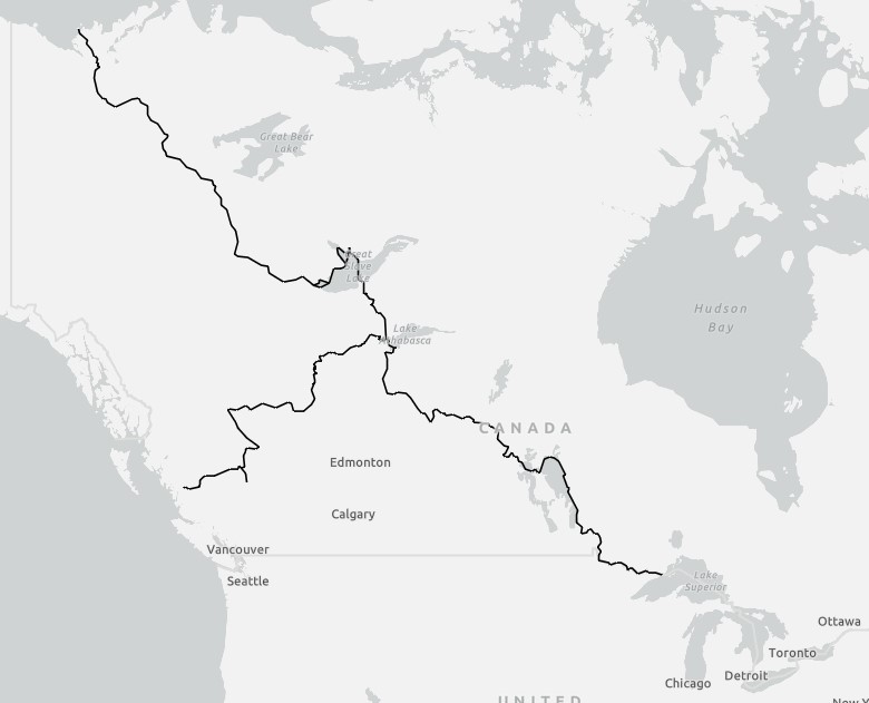
In 1789, eager to find a route to the Pacific Ocean and guided by Indigenous knowledge and supported by voyageurs, Mackenzie led an expedition from Fort Chipewyan on Lake Athabasca and followed what he hoped was a westward river route. Instead, the Mackenzie River carried him northward, all the way to the Arctic Ocean. The Mackenzie River, is the longest river system in Canada and the second longest in North America. Disappointed, he nonetheless became the first European to reach the Arctic by an overland route through Canada.
Determined to reach the Pacific, Mackenzie set out again in 1792. This time, he and his party traveled across the Rockies by way of the Peace, Parsnip, and Fraser Rivers, then overland to the Bella Coola River. On July 22, 1793, Mackenzie reached the Pacific Ocean at Dean Channel, British Columbia. This achievement made him the first European to cross North America overland north of Mexico, a full twelve years before Lewis and Clark’s famous expedition.
Mackenzie returned to Montreal in 1794 and sailed to England, where he published his journals as Voyages from Montreal… (1801). The work gained him fame, and in 1802 he was knighted by King George III. He later returned to Scotland, marrying Geddes Mackenzie, and settling into a quieter life. Sir Alexander Mackenzie died in 1820, at the age of 56, in Scotland.
Mackenzie’s travels were researched from his published journal and other records. From the completed research, spatial data was created and is organized into the fields Year, Route, Leg, Departed, Arrived, Origin, and Destination. The data is in ESRI shapefile format and can be acquired HERE.
A Map of the Travels and Explorations of Alexander Mackenzie 1789-1793